When the Colorado River swelled in mid-October, it wasn’t just another storm on the news. The remnants of Tropical Storm Priscilla brought record rainfall to parts of Colorado, and that surge moved through the river system all the way down to Bullhead City. Water levels rose, sediment shifted, and banks along Lake Mohave quietly changed shape. For homeowners near the river, this kind of natural reshaping can do more than move sand. It can change how your elevation certificate lines up with the real ground under your home.
An elevation certificate is the document that shows how your property’s height compares to the official flood level, known as the Base Flood Elevation. It’s the form your insurance company, lender, and city use to decide how much risk—and cost—you face. Normally, once you have one, you tuck it away until a renewal or sale. But after storms like this October’s deluge, the ground itself can subtly shift. That means your old data might no longer tell the whole truth.
When Floods Change the Ground Beneath You

Floods don’t always carve dramatic new river paths. Sometimes they leave behind quiet surprises—layers of silt in one area, washed-out soil in another. Along the Colorado River, high flows can deposit inches of new material on one property while scouring away the bank next door. Even a few inches of difference can throw off the measurements used in your certificate.
Here’s why it matters. The lowest point around your foundation, called the Lowest Adjacent Grade, is compared against FEMA’s flood-map elevation. If last week’s flood left behind new soil or pulled it away, that “lowest point” may have changed. It might now sit closer to—or below—the flood level. Insurers and lenders rely on those numbers, so a small shift can change how they classify your risk.
During early October, the Bureau of Reclamation intentionally lowered Lake Mohave’s level for fish-habitat operations. When the river surge followed days later, the sudden refill stirred up massive amounts of sediment. Once the water receded, surveyors started noticing minor but widespread elevation differences near retaining walls, docks, and irrigation lines. These are the subtle signs that tell you it’s time to double-check your data.
Signs Your Certificate Might Be Out of Date
You don’t need to be a surveyor to spot warning clues. Walk your property after a major storm and pay attention to anything that looks different from before. Are your fence posts leaning? Has a bit of soil disappeared near your patio? Did you notice new sand buildup around your seawall or dock? These small details show how water rearranges the landscape.
Another red flag appears when drainage suddenly behaves differently. Maybe a corner of the yard that stayed dry now collects water after light rain. That could mean the ground has settled or shifted just enough to change slope. In riverfront neighborhoods, that’s not just a drainage issue—it can signal a new elevation that no longer matches what’s printed on your certificate.
If you plan to refinance, renew insurance, or apply for a building permit soon, re-checking your elevations before paperwork starts can save headaches. Surveyors say many homeowners wait until their insurance company demands an update, only to discover that their old certificate no longer passes review.
What “Re-Validation” Really Means
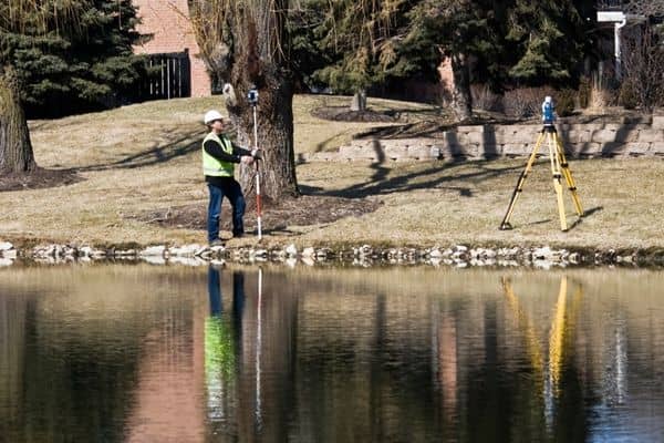
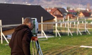
Re-validation isn’t a full do-over. It’s more like a check-up. A licensed land surveyor revisits your property, compares current ground levels with the benchmarks used in your existing certificate, and confirms whether anything changed. With today’s GNSS tools, that process is quick and precise.
The surveyor measures key points around your foundation, cross-checks them with federal control monuments, and reviews the vertical datum used on your original document—NAVD 88, the standard for FEMA. If the differences fall within normal tolerance, your certificate remains valid. If not, the surveyor updates the form so the numbers match current conditions.
It’s a smart step because FEMA maps and insurance calculations depend on accurate, recent data. A five-year-old certificate might still look fine on paper, but after a flood event like October’s, the real ground could be telling a different story.
Why This Matters So Much in Bullhead City
Bullhead City has always balanced two extremes—desert washes that rush water off hard soil and a powerful river that shifts with every season. Development along the riverbank, from Riverfront Drive to Laughlin Ranch, sits close to FEMA-mapped flood zones. These properties are especially sensitive to grade changes.
When Lake Mohave’s level rises quickly after being drawn down, waves and currents eat away at exposed banks. Retaining walls and riprap take most of the hit, but the soil behind them can settle. Even a small slump can alter the elevation readings that define your flood risk.
Local surveyors often see this pattern: after big storms, they revisit sites and find the “lowest adjacent grade” has changed by half a foot. That’s enough to bump a home into a higher risk bracket unless the certificate is corrected. It doesn’t mean the property suddenly became dangerous—it simply means the official paperwork needs to reflect new ground truth.
How Re-Checking Protects Your Wallet
Updating an elevation certificate costs far less than letting outdated data linger. Insurance companies use your numbers to assign flood premiums. If the certificate shows your home sits higher than reality, you could face claim problems later. If it shows you lower than you really are, you’re probably overpaying every year.
Lenders also watch for mismatched certificates during refinancing or sales. A quick re-validation now can prevent delays when rates drop or buyers appear. Think of it as maintaining your home’s credentials—the same way you’d update a car title after repairs or modifications.
Another benefit is peace of mind. After the October floods, many residents wondered whether their neighborhood’s drainage systems held up. Having a surveyor confirm that your elevations are still accurate gives you clear answers, not guesswork.
Simple Steps to Take After the Storm
Start by documenting what you see. Take photos of banks, fences, and any new soil lines. Keep them with your existing elevation certificate. If your property backs directly onto the river or a major wash, consider calling a surveyor for a quick site review. They can compare your ground points to official benchmarks in minutes and tell you if anything looks off.
Even if everything checks out, you’ll have professional confirmation that your certificate remains accurate. That assurance matters when flood-map updates roll out or when you negotiate insurance rates.
Moving Forward With Confidence
The October deluge reminded everyone in the Colorado River corridor how connected upstream and downstream really are. A storm hundreds of miles away can shift sediments and reshape banks right here in Bullhead City. Those quiet changes are exactly what an elevation certificate measures, which is why keeping it current matters more than ever.
If you already have a certificate, treat it as living data, not a one-time form. The river changes, the ground moves, and smart homeowners keep their paperwork in step. Before the next renewal cycle—or the next monsoon season—schedule a quick re-validation. It’s a small effort that protects your investment, your insurance rate, and your peace of mind.
Because when the river rises again, you’ll want your numbers to rise with it—accurate, updated, and ready for whatever comes next.


