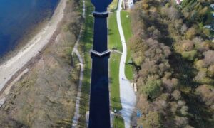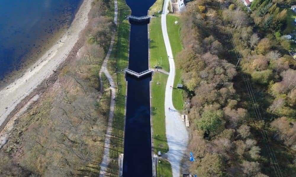
Planning to rehabilitate a canal? You need a clear picture of the corridor first. Canals often run for miles. Many parts are hard to reach on foot. That makes ground survey work slow and costly.
Aerial surveying solves this problem. Drones with cameras or LiDAR sensors fly over the canal and capture what is there. This method can map bank slopes. It can spot erosion. It can show plant growth along the banks. It can also record nearby structures. All of this happens without shutting down long stretches of the canal.
Aerial surveying does have limits. It cannot see through deep or fast moving water. Knowing where this method works well, and where you still need ground crews, helps your project run smoother from the start.
Mapping the Canal Corridor Before Rehabilitation Design
Aerial surveying gives engineers one clear view of the whole canal corridor. A drone can fly the full length of a canal segment in one trip. This creates one complete set of data instead of scattered notes from many site visits.
This matters because canal conditions change from spot to spot. One section might have minor bank settling. Another might have thick plants or a failing slope. When you see the whole corridor at once, it is easier to decide where work should start first.
This method also speeds up early planning. A survey crew flies the corridor one time instead of visiting many times. Engineers can often get a working base map within days. That map becomes the starting point for everything else, including bank measurements and structure locations.
Canals often pass through desert land, neighborhoods, and industrial areas. Ground access can be tricky in these mixed settings. Aerial surveying skips most of that trouble by collecting data from the sky.
Capturing Bank Crests, Toes, and Visible Channel Geometry
Bank crest and toe locations matter a lot for canal rehabilitation design. Aerial surveying can capture both fairly well. This works best when the banks are visible and not blocked by thick plants or standing water.
The crest is the top edge of the bank slope. The toe is where the slope meets the bottom or the water line. These two lines show the slope shape. Engineers use them to see how much material has eroded, settled, or shifted since the canal was last built or surveyed. Aerial LiDAR can build a detailed elevation model of the bank. This lets engineers measure slope angles and compare them to the original design.
Aerial surveying also handles the visible channel shape well. This includes spots where banks have widened from erosion. It also shows where slope protection has slipped or failed, and where sediment or debris has piled up along visible edges.
How accurate this data turns out depends on flight conditions. Plants hanging over the bank, shadows from nearby buildings, and water levels during the flight can all change what the data shows. A flight during low water usually reveals more of the channel than one flown when water levels are high.
Documenting Structures Along the Water Conveyance Route
Canal corridors rarely stand alone. Bridges, culverts, headgates, siphons, drop structures, and access points show up along most routes. Each one needs to be documented before rehabilitation design moves ahead.
Aerial surveying can capture the location, direction, and general condition of these structures. This happens during the same flight used for bank mapping. Engineers get one dataset that shows the channel and its structures together. That makes it easier to spot problems early. If a plan calls for widening a section, the team needs to know if a nearby structure will be affected.
Aerial images can also show visible wear on structures, such as cracked concrete or exposed metal. This will not replace a hands-on inspection. But it can flag areas that need a closer look before design work moves forward.
For canals that cross roads, utility lines, or neighborhoods, this structure record often becomes one of the most useful parts of the survey. Planning work around existing structures gets easier when the design team already knows what is out there.
Converting Aerial Surveying Data Into Design-Ready Surfaces
Raw aerial data cannot go straight into design software. It has to be processed first. This usually means building a digital elevation model or a surface map that shows the canal corridor in three dimensions.
This step involves sorting the data points and clearing out plants and noise. The goal is a surface that reflects real ground and bank conditions, not treetops or loose debris. Once that surface is ready, engineers can pull cross sections. They can calculate slope grades. They can compare the current corridor to the proposed design.
The quality of this surface depends on how carefully the data was collected and cleaned. A rushed job can leave plant clutter in the model. This throws off slope numbers. It can lead to design mistakes if nobody catches it early. It helps to check the finished surface against known reference points before it goes to the design team.
Pairing Aerial Mapping With Targeted Ground Verification
Aerial surveying works best as part of a bigger plan. It is not a full replacement for ground survey work. Some features along a canal cannot be measured from above. Knowing where those gaps are ahead of time can save you from delays later.
Submerged channel bottoms are the clearest example. Standard cameras and most LiDAR systems cannot see through water with much accuracy. Anything below the water line usually needs ground measurement. It might need hydrographic survey methods. It might need a survey done during a planned drawdown. Buried utility lines, soil conditions below the surface, and structural details hidden by plants or shadow also fall outside what aerial data alone can confirm.
A smart approach is to use the aerial survey first to find out where ground checks are actually needed. This beats sending a crew to walk the entire corridor. If the aerial data shows a section with unclear bank shape or a structure that needs a closer look, that spot becomes a targeted ground visit. It does not need to be a task for the whole project. This mix usually gives engineers the most complete and reliable data. It also keeps costs down compared to surveying every foot by hand.
Frequently Asked Questions
Can aerial surveying map the bottom of a water-filled canal?
Standard aerial photogrammetry generally cannot measure submerged canal surfaces with reliable accuracy. Getting usable data below the water line usually calls for hydrographic survey methods, bathymetric equipment, or a flight scheduled during a planned drawdown when the channel bottom becomes visible.
When should a canal aerial survey be completed?
Timing depends on several things at the site. This includes current water levels, plant growth along the banks, access limits, and the project’s design schedule. Coordinating flight timing with the design team and the canal operator helps make sure the data shows the conditions that actually matter.
Can aerial data reveal canal bank erosion?
Aerial surveying can document visible signs of erosion. This includes slope changes, slumping, exposed soil, and shifted material along the bank. Confirming how stable an eroded bank really is, though, often calls for a geotechnical review too.