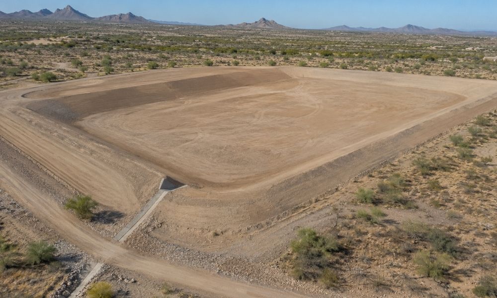
A recharge basin that works well at its current size can act differently once it gets bigger. In Arizona, these basins collect water and let it soak down into the ground, refilling the aquifer that many communities depend on. Growing one is rarely as simple as digging out more space.
When a basin expands, its edges shift. The slope of the surrounding ground changes. Inlet and outlet points may sit in new spots. And the basin now touches land and structures it never touched before. Those new relationships all come down to height, or vertical position.
An elevation survey records that vertical information. It gives engineers measured heights across the site so they can plan the expansion around real conditions instead of guesses. The survey itself does not study how water moves underground or how fast the soil drains. That work belongs to hydrologic and geotechnical specialists. A surveyor measures what the site looks like today, in feet and fractions of feet.
Start With the Existing Basin’s Vertical Footprint
Before anyone plans a larger basin, the design team needs to know the heights of the basin that already exists. You can’t extend something without knowing where its current floor, banks and edges sit. Those heights are the starting point for everything that follows.
An elevation survey around an existing recharge basin captures the ground heights along the top of the banks and down into the basin floor. It also records the heights of any built features tied to the basin, like inlet structures, spillways or maintenance ramps. These points describe the shape of the basin as it stands.
The survey doesn’t stop at the water’s edge. It follows the height changes where the basin meets the land around it. The crew measures access roads, the pad next to a control structure and the strip of ground between the basin and a nearby fence. Each of these areas connects to the basin in some way.
Together, these heights form a picture of the basin’s vertical footprint. The design team starts from that measured base instead of old plans that may no longer match the ground. Old records can drift out of date after years of settling, grading or repair work.
Trace the Grade Changes Beyond the Basin Edge
An expansion doesn’t stay inside the old basin. It reaches into ground that was never part of the facility. So the survey has to reach there too.
Past the current edge, the land rises and falls in ways that matter for the new design. A gentle slope away from the basin may need reshaping. A high spot might block where water is supposed to flow. The survey records these height changes across the area where the basin will grow.
Engineers build their grading ideas on the link between what exists and what’s proposed. If the new basin floor needs to sit at a certain height, the team has to know how far the current ground is above or below that point. Measured heights answer that question.
Nearby features matter when they touch the project. A drainage channel along one side, an earthen berm or a service road can all shape how the expansion fits. The survey notes their heights so the design team can see how the new basin lines up with them. The point is the vertical relationships, not a picture of every feature on the site.
Give Engineers a Reliable Vertical Starting Point
Design work needs numbers it can trust. An elevation survey gives engineers field-measured heights taken at the site, not estimates pulled off a screen. Those readings come from a crew working on the actual ground.
Every good survey ties its heights to a vertical reference, called a datum. In many projects, that reference is NAVD88, a national standard for measuring height above sea level. The survey should state which datum it used. That way, every height on the plan speaks the same language.
This matters most when old and new parts of the basin have to work together. If the existing basin uses one reference and the expansion uses another, the plans won’t line up. A shared datum keeps the whole project on one consistent set of heights.
There’s a clear limit to what the survey can tell you. It does not measure how much water the soil can take, how fast water soaks in or how high the groundwater sits. It says nothing about how well the basin will perform once it holds water. Those answers come from hydrologic, hydrogeologic and geotechnical studies. The survey handles the shape of the site. The other experts handle how water behaves.
Check the Expansion Against Nearby Water Infrastructure
A recharge basin rarely sits alone. It connects to pipes, channels and other parts of a water system. When the basin grows, those connections need a second look.
The survey supports that check by measuring the heights of features the basin ties into. A pipe that carries water into the basin has an elevation at its opening. The floor of a channel feeding the basin sits at its own height. So does an access point or a control structure. Comparing these heights to the proposed design shows where things match and where they don’t.
Say the plan puts the new basin floor lower than the pipe that feeds it. Measured heights bring that mismatch into view early, while it’s still easy to change on paper. The survey doesn’t decide how to fix it. It gives the design team the height facts they need to work out a fix.
This is coordination, not design. The surveyor reports what the elevations are. The engineers decide what those elevations mean for the plan.
Build the Expansion Plan From Measured Site Conditions
Once the fieldwork is done, the survey becomes part of the information the engineering team builds on. It’s not a stack of numbers set aside in a drawer. It shapes the plan from the start.
A typical set of survey results for a project like this might include:
- Surveyed ground and structure heights across the basin and expansion area
- Control points that tie the site to a known datum
- A map of the features that affect the design, such as inlets, channels and access roads
Getting these heights on record before design begins protects the whole plan. Once a design assumes a certain ground height, that number carries through every later step. If the real ground sits lower or higher, the mistake follows the project into construction. Measured field conditions keep those assumptions honest.
It helps to keep the two kinds of work separate in your mind. The survey tells you what the site’s elevations are. The engineering work tells you how the basin should be shaped and how it should function as a recharge facility. You need both. Neither replaces the other.
If you’re planning to expand a recharge basin, start with an elevation survey from a licensed surveyor who works on local water projects. Measured heights of your real site give your engineers a solid base to design from. They also help the whole team avoid surprises once the work moves into the field.