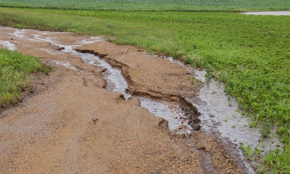
Arizona has seen heavy storms and flash floods in recent days, leaving behind damaged roads, overflowing washes, and heartbreaking losses. For many families and businesses, including Kingman, the land itself has changed in ways that aren’t always visible at first glance. That’s where a topographic survey becomes critical. After major floods, the ground doesn’t look the same as it did before—contours shift, washes cut new paths, and sediment piles up where it never existed. If you’re planning to repair, rebuild, or develop property, a fresh survey is not optional. It’s essential.
Floods Don’t Just Soak the Ground—They Reshape It
When rain pours hard and fast across desert terrain, the soil can’t absorb it quickly. Instead, stormwater races downhill, carving channels through yards, roads, and construction sites. Ephemeral washes, which may look dry most of the year, can turn into raging streams in minutes.
During the recent floods, roads were shut down, and tragic deaths were reported across the state. While the headlines focused on Phoenix and Globe, Kingman and other towns along the I-40 corridor face the same risks. Washes overflow, culverts back up, and new erosion scars appear overnight.
This sudden reshaping of the land makes older surveys unreliable. A map that was accurate last year may already be outdated. A fresh topographic survey captures today’s conditions, not yesterday’s guesses.
Why Old Data Can Cost You
Think of your property like a puzzle. Every elevation point, contour line, and slope direction is a piece of that puzzle. Floods scramble those pieces. If you try to build or repair using old information, you’re setting yourself up for mistakes.
For homeowners, that could mean re-pouring a driveway only to find that water now flows toward your house instead of away from it. For developers, it could mean submitting a site plan that gets rejected because elevations no longer match reality. Contractors face delays and rework when the ground doesn’t match their grading plans.
The cost of these errors often far outweighs the cost of ordering a new survey. That’s why engineers and local officials push for updated topographic data after major storm events.
What a Post-Storm Topographic Survey Reveals
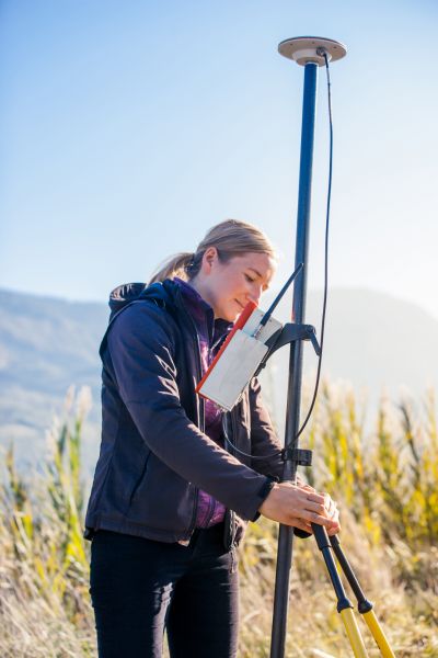
A post-storm survey doesn’t just measure the land; it shows the story of how the flood changed it. For example:
- New flow paths. Washes may have shifted, deepened, or widened. A survey captures these changes before they cause future flooding.
- Infrastructure shifts. Culvert inlets and outlets may be buried, eroded, or damaged. Survey crews record exact elevations to guide repairs.
- Drainage problems. Valley gutters and cross-slopes sometimes warp under heavy runoff. Accurate elevations show where adjustments are needed.
- Hazard areas. Scour holes, debris piles, and unstable slopes are documented so they can be fixed before construction resumes.
By tying the survey to reliable datums like NAVD88, engineers and contractors get precise, up-to-date information to work with.
How to Check Flood Risk on Your Property
You don’t need to be a surveyor to take the first step. Mohave County offers an online “Is My Property in a Flood Zone?” tool, which lets you see if your land is near a Special Flood Hazard Area. FEMA also provides maps that outline official flood zones.
These tools are helpful, but they don’t tell you what happened on your lot last week. They show long-term risk, not fresh erosion. That’s why pairing them with a current topographic survey gives you the full picture.
Real-World Scenarios in Kingman
Imagine a commercial property along US-93 that was graded perfectly last year. The owner planned to break ground this fall. After the flood, however, a new channel cuts through the corner of the site. Without a survey, the grading contractor wouldn’t catch it until equipment was already on site. The result? Weeks of delay and thousands of dollars in changes.
Or consider a neighborhood driveway that slopes toward the street. Heavy rain carved a shallow trench, redirecting water straight toward a garage. A quick topo survey would show the change in slope, giving the homeowner the evidence needed to fix the grade before pouring new pavement.
These are the kinds of hidden issues that only accurate mapping reveals.
Why Acting Quickly Matters
Flood damage doesn’t wait for convenience. Sediment continues to shift, and temporary fixes often don’t hold. The sooner you order a survey, the sooner you know the true state of your property. Acting quickly also helps with insurance claims and city approvals. Officials want clear, current documentation before they sign off on repairs or new builds.
Delaying can create bigger problems. A site plan drawn from outdated contours might be rejected, forcing you to pay for revisions and lose valuable time.
Who Needs a Post-Storm Survey the Most
- Homeowners who saw water pooling in new places.
- Developers with active projects or pending permits.
- Contractors responsible for grading, paving, or drainage repairs.
- Lenders and insurers evaluating flood-related claims.
If your property falls into one of these groups, a topographic survey after the storm is not just a formality—it’s protection against future headaches.
Final Thoughts
Arizona floods are powerful reminders that land is never static. What looks stable today can shift overnight with one heavy storm. For residents and businesses, the recent floods reshaped more than just the landscape—they reshaped the risks of building and living on it.
A topographic survey gives you the confidence that your data is current, your plans are accurate, and your property is protected. Whether you’re rebuilding, repairing, or planning for the future, don’t rely on outdated information. Order a survey now, and move forward with the assurance that your project rests on solid, up-to-date ground.
