Before You Order a Land Survey, Check This First
If you’re planning to buy land, build a home, or add something to your property, you’ve probably heard this advice: get a land survey first. It sounds like the right move. However, most people don’t realize there are a few things to sort out first before getting a land survey. Many property owners rush into […]
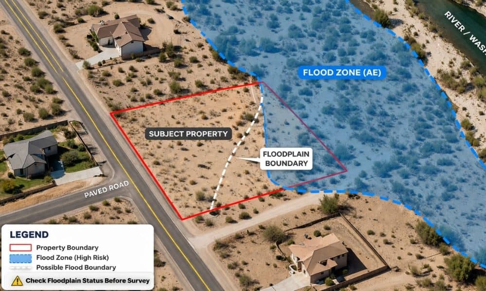
What a Property Survey Shows and Why Maps Aren’t Enough
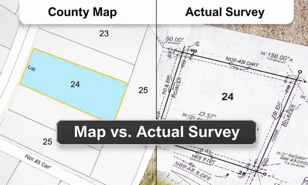
If you’ve ever looked up a property online, you’ve probably seen those clean lines on a county map and thought, “That looks pretty clear.” The lot shape seems simple. The boundaries look exact. It feels official. However, that confidence can be misleading. Many people rely on those maps before buying land or planning a project. […]
How Drone Surveying Maps Large Properties Faster

Mohave County has a lot of open land. In fact, many properties around Kingman, Golden Valley, and the surrounding desert cover dozens—or even hundreds—of acres. Because of that, understanding the full layout of a property can be difficult. Landowners often want to see what their land looks like before making big decisions. This is where […]