If you’re planning to buy land, build a home, or add something to your property, you’ve probably heard this advice: get a land survey first. It sounds like the right move. However, most people don’t realize there are a few things to sort out first before getting a land survey.
Many property owners rush into ordering one without checking what really matters. Then later, they find out their property sits in a flood-prone area. Because of that, they need more work, more time, and more money.
So before you spend anything, there’s one simple step that can save you from all of that—check your floodplain status first.
Why Floodplain Status Should Come Before a Land Survey
At first, it feels natural to start with a land survey. After all, you want to know your boundaries, your layout, and what you’re working with. But if you’re not really sure what a land survey shows, it’s easy to jump into it too quickly.
However, floodplain status changes everything.
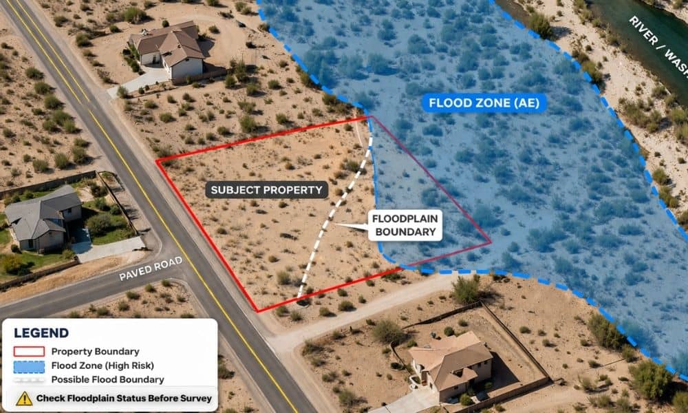
If your land falls inside a flood zone, your plans may shift right away. You might face building limits, design changes, or extra approvals. Because of this, the type of land survey you need may also change.
So instead of starting with the survey, it makes more sense to start with the condition of the land itself. That way, every step after that becomes clearer.
What Floodplain Status Means for Bullhead City Properties
Floodplain status tells you if your land has a higher risk of flooding. In Bullhead City, this matters more than many people expect.
The area sits close to the Colorado River. It also has desert washes that can fill quickly during heavy rain. Even if your lot looks dry most of the year, it can still fall within a mapped flood zone.
Because of that, floodplain status can affect what you’re allowed to do with your property. It can shape how you build, where you build, and how your project moves forward.
So this is not just a technical detail. It’s a key part of understanding your land before making any decisions.
How to Check Floodplain Status Before Ordering a Land Survey
The good news is this step is easier than most people think.
You can start with a basic floodplain check using local resources or mapping tools. This gives you a quick idea of whether your property might be in a flood zone.
After that, if you’re serious about your plans, you can request an official determination. This confirms your property’s status and gives you something solid to work from.
Once you have that information, you can move forward with confidence. You’ll know whether your project needs extra steps or not. More importantly, you’ll avoid guessing.
What Can Go Wrong If You Skip This Step
Skipping the floodplain check often leads to problems that show up later.
For example, someone orders a land survey right away. They wait for the results and assume everything is fine. Then, during planning or permitting, they find out the property sits in a flood zone.
Now the situation changes. They may need more data, more approvals, or even a different approach to the project. As a result, the timeline stretches and costs increase.
This kind of setback is frustrating, especially because it could have been avoided with a simple check at the start.
How Floodplain Status Can Change Your Land Survey Needs
Not every property needs the same type of land survey. That’s where many people get confused.
If your property sits outside a flood zone, your survey needs may stay simple. You can move forward without extra layers of work.
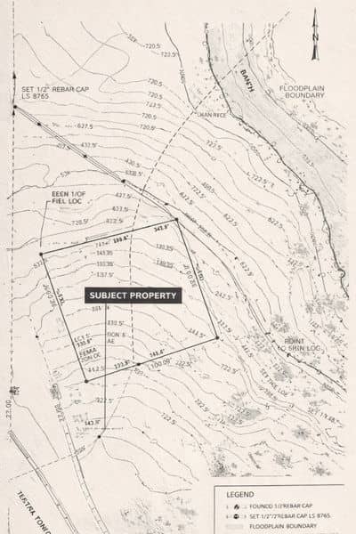
However, if your property falls inside a floodplain, things become more detailed. The survey may need to include more precise data, and your plans may need to adjust.
Because of this, floodplain status helps define what kind of land survey actually fits your situation. Instead of ordering something too basic or too complex, you can choose the right level from the start.
Why Talking to a Land Surveyor Early Can Help
Even though the floodplain check comes first, you don’t have to figure everything out alone.
Talking to a licensed land surveyor early in the process can make a big difference. They can look at your property, understand your plans, and guide you toward the right next step.
This is especially helpful if your property has unique features, like slopes, drainage paths, or nearby water. In those cases, getting advice early can prevent mistakes later.
Instead of reacting to problems, you stay ahead of them.
A Simple Way to Think About It
There’s an easy way to remember this process.
Check the condition of the land first. Then decide on the survey.
When you start with floodplain status, you remove the guesswork. You know what you’re dealing with before you spend money on anything else.
That makes every step after that smoother and more predictable.
Final Thoughts
Ordering a land survey is an important step. However, it shouldn’t be the first one.
If you jump in too early, you risk delays, added costs, and unnecessary stress. On the other hand, if you take a moment to check floodplain status first, you set yourself up for a smoother process.
So before you move forward, pause and look at the bigger picture.
Check your floodplain status first. Then order your land survey with confidence.
That one simple step can save you time, money, and a lot of frustration.