Thinking of building in Arizona? Whether you’re planning a custom home in Scottsdale or a commercial project in Tucson, chances are you’ll come across the term topographic survey early in the process.
But what exactly is it, and why might you need one? In this guide, we’ll break it down in simple terms—no jargon, just real-world insight tailored for Arizona property owners, developers, and real estate professionals.

Understanding the Basics: What Is a Topographic Survey?
A topographic survey—also known as a “topo survey”—maps the shape, elevation, and surface features of a piece of land. It shows not just where things are, but how the land rises, falls, and flows.
This includes:
- Elevation contours and slope information
- Natural features like hills, washes, trees, and boulders
- Manmade features such as roads, walls, buildings, and utilities
Unlike a boundary survey (which identifies property lines), a topographic survey focuses on what’s on the land and how it varies in height and terrain.
Why Are Topographic Surveys Important in Arizona?
Arizona’s diverse terrain—from flat desert parcels to steep foothills—makes understanding elevation critical for any kind of land use or construction.
Here’s why a topographic survey is especially vital in Arizona:
- Drainage design: Arizona’s monsoon storms can cause sudden flooding. Topo data ensures your property drains properly. Accurate site elevation mapping helps prevent drainage and grading issues, especially in Arizona’s desert terrain.
- Grading and site prep: Builders need to know how much earth to cut, fill, or level.
- Permit requirements: Cities like Phoenix, Chandler, and Flagstaff often require topographic data for permit approval.
- Desert conservation overlays: Certain areas require developers to avoid disturbing natural washes or desert features.
When Do You Need a Topographic Survey in Arizona?
You should consider a topographic survey if you’re involved in any of the following:
1. New Construction Projects
Whether it’s a custom home in Sedona or a commercial plaza in Mesa, your architect or engineer will need accurate elevation data to design foundations, utilities, and stormwater plans.
2. Remodeling or Additions on Sloped Lots
Even if you’re not building from scratch, Arizona properties with uneven terrain or desert washes often require topo data before expanding structures.
3. Grading or Drainage Work
Before altering the ground surface, a topo survey can help engineers design safe and code-compliant slopes, swales, or retaining walls.
4. Permitting in Sensitive Zones
Maricopa and Pima Counties often require topo surveys for lots in hillside overlay zones or floodplain areas.
5. Subdividing Land or Planning Developments
Large-scale development? You’ll need a topo map to lay out roads, lots, and stormwater systems.
Topographic Survey Tools & Methods
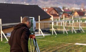
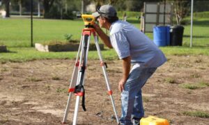
Professional Arizona land surveyors use a range of technology to conduct topographic surveys:
- Total stations and GPS equipment for accurate on-site data collection
- Aerial drones or LiDAR mapping for large, complex, or inaccessible parcels
- CAD software to produce maps with elevation contours and surface features
All this ensures the final map is precise and tailored to Arizona’s unique zoning and land-use requirements.
Topographic vs. Boundary Surveys: What’s the Difference?
| Survey Type | Main Purpose | Elevation Info? |
| Topographic Survey | Maps terrain and surface features | ✅ Yes |
| Boundary Survey | Defines legal property lines | ❌ No |
| ALTA/NSPS Survey | Combines topo + title data | ✅ Often |
| Elevation Certificate | Measures base flood elevations | ✅ Flood-specific |
Many Arizona property owners order both a boundary and topographic survey for complete site planning.
Real Example: Custom Home Site in North Scottsdale
A family purchased a desert lot with beautiful mountain views near McDowell Sonoran Preserve. Before designing their dream home, their architect requested a topographic survey to:
- Map elevation contours for site placement
- Ensure the design met hillside ordinance requirements
- Plan proper drainage during monsoon season
The topo survey revealed a natural wash near the back of the lot—helping the team adjust the layout and avoid costly delays with city planning.
How Much Does a Topographic Survey Cost in Arizona?
Costs vary depending on location, terrain, and site size. Typical price ranges:
- Residential Lots (¼ to 1 acre): $1,200–$2,000
- Larger or Complex Sites: $2,500–$5,000+
- Hilly or Remote Areas: May cost more due to accessibility
Need a precise quote? Contact a licensed land surveyor in Arizona familiar with your city’s requirements.
Final Thoughts: Know Your Land Before You Build in Arizona
A topographic survey is not just another box to check—it’s a powerful planning tool that can save you time, money, and legal headaches, especially in Arizona’s varied landscape.
Before you break ground, make sure you’ve mapped what matters most—the shape and soul of your land.
FAQs About Topographic Surveys in Arizona
1. Do I need a topo survey for a building permit in Phoenix?
Often, yes—especially for grading, stormwater, or hillside properties.
2. Can I combine a boundary and topo survey?
Yes. Many clients request a combo for full site planning and permitting.
3. How long does a topo survey take?
Most take 2–5 business days depending on property size and conditions.
4. What’s included in the deliverable?
A CAD or PDF map showing contour lines, elevation data, and key site features.
5. Are topo surveys valid for floodplain design?
They help, but an Elevation Certificate is needed for FEMA flood compliance.
6. Can a topo survey help avoid drainage problems?
Absolutely. It helps engineers plan proper grading to protect your home and site.
