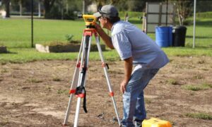
When it comes to owning property, one of the most overlooked yet essential steps is hiring a land surveyor. Whether you’re buying, building, or resolving a boundary issue, a professional surveyor offers clarity and legal protection that can save you time, money, and stress. Imagine investing in your dream home, only to face disputes over where your land ends and your neighbor’s begins. A certified land surveyor prevents these headaches by defining precise property lines and uncovering any hidden encroachments or easements. In this article, we’ll explain why every property owner should have a trusted land surveyor—and how their expertise ensures your investment is protected for years to come.
What Is Land Surveying?
Land surveying is both a science and an art. It involves measuring land accurately—establishing legal boundaries, mapping terrain, and noting features like buildings, fences, and elevation changes. The result? A reliable, legally binding record that defines your property, helping you make informed decisions on buying, building, or selling.
How Do Professional Surveyors Work? – Techniques & tools
Traditional vs. Modern Surveying Tools
Surveyors once relied on theodolites and measuring tapes. Now, they use GPS, laser scanners, drones, and Geographic Information Systems (GIS) to gather faster and more precise data.
Legal and Geographic Knowledge Integration
Surveyors merge technical accuracy with legal documentation. They research deeds, follow municipal regulations, and plot your boundaries on a plat that’s accepted by courts, lenders, and local authorities.
Top Benefits of Hiring a Licensed Land Surveyor
Accurate Boundary Determination
Avoid guesswork with property corners and lines—get precision you can rely on.
Avoiding Encroachments & Neighbor Disputes
Stop fence, patio, or structure encroachments before they spark conflict and legal fees.
Compliance with Zoning Laws & Permits
Need building permits? Only a professional surveyor can provide code-compliant site documentation.
Protecting Your Property Rights
Secure your investment with legally defensible proof of your property’s true limits.
Different Types of Land Surveys
Boundary Surveys
Legally define your property lines with marked corners. Essential for deed preparation, resolving encroachments, and getting permits.
Topographic Surveys
Map the land’s features—elevation, slope, vegetation, and existing structures—for planning builds or assessing drainage.
Construction Staking Surveys
Surveyors translate architectural plans into real-world markers—ensuring everything is built to spec.
Subdivision & Land Development Surveys
Divide larger parcels into buildable lots, complete with street and utility layouts, per local requirements.
Debunking Common Land Surveying Myths
It’s only for large properties
Even small urban lots need surveys to avoid disputes over fences or landscaping.
One survey lasts forever
Land changes; fences move. After renovations or neighbor activity, resurvey your property.
Existing documents are enough
Old deeds/plats can be inaccurate or dated—field verification is key.
It’s always prohibitively expensive
While costs vary, the long-term legal protection and clarity you gain outweigh the fee.
What to Expect When Hiring a Surveyor
- Finding experts: licensing and credentials. Look for licensed professionals via directories like NSPS or state boards—check portfolios and references.
- Initial consultation & quoting. Discuss your property’s needs—survey type, site characteristics—and get a clear quote.
- On-site fieldwork and data collection. Surveyor visits your land, measures, marks points, and maps any easements or encroachments.
- Deliverables: maps, plats, and reports. You receive a detailed plat map, a written report, and official documentation you can use in legal or real estate transactions.
How Survey Fees Are Determined
- Property size and terrain complexity – More acres and rough terrain = more time = higher fees
- Types of surveys and tech used – Combining boundary, topo, and construction surveys costs more—especially with drones or GPS tools.
- Location and regulatory factors – Urban areas with dense infrastructure or strict codes may increase costs.
Real‑Life Surveying Success Stories
- Fence Dispute Resolution – Suburban owner resolved a neighbor’s fence encroachment using precise survey data.
- Subdivision Planning – Developer avoided costly permit delays after discovering terrain issues early.
- Unknown Easement Discovery – Rural landowner negotiated a new agreement after a survey revealed an old easement.
Conclusion: The Value of Professional Land Surveys
Unlocking the secrets of land surveying reveals its real value: clarity, legal protection, and informed decision‑making. Whether you’re resolving disputes, planning construction, or safeguarding your property rights, a licensed surveyor is your essential partner. Don’t let ambiguity threaten your investment—embrace professional surveying and secure your real estate success.
FAQs
1: What if my neighbor built over my property line?
A boundary survey can confirm the encroachment. With precise evidence, you can negotiate removal or relocation—no guessing needed.
2: Do I need a new survey when building?
Yes. New construction requires up-to-date boundary and topographic surveys to comply with permits and zoning.
3: Can’t I just use old records from my deed?
Deeds and old plats may be inaccurate. Only a licensed surveyor can measure the current, real-world boundaries.
4: How long does a standard survey take?
Small residential surveys: days. Larger or complex sites: up to several weeks—depends on site complexity and permitting.
5: Is it okay to DIY survey my land?
No. DIY is risky—your measurements won’t hold up legally, and you can make costly mistakes. Always hire a licensed professional.
6: Are survey fees tax deductible?
Often yes—if the survey is required for a home purchase or mortgage, it may qualify as a deductible closing cost. Check IRS rules or consult a tax advisor.
