Why You SHOULD Have a Land Survey Completed Before Purchasing Land?

Buying land, whether commercial or residential, is always an expensive endeavor, even if prices have eased somewhat lately. This is why finding a piece of land that you like and making an offer for it without conducting a land survey on the area is possibly the biggest mistake that you can make.

Here’s why it’s very important that you have land surveying done first:

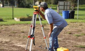
Land surveyors can determine if you’re actually getting what you’re going to pay for. This means find out whether the sidewalks, trees, driveways and even the bird bath is part of the property you’re about to buy. Land surveying would also determine whether the neighbors are encroaching into the property, which would then mean you’re going to have problems in the future with your neighbors.
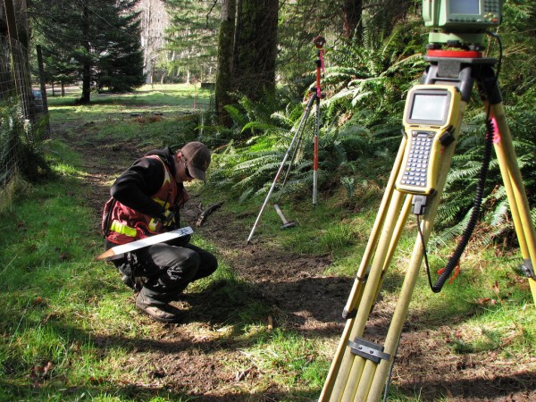
Land SurveyHiring a lamand surveyor doesn’t only mean they determine what you’re getting or not getting – land surveyors are the experts, and they can help with building regulations, wetland regulations, etc. Take note that these regulations can change anytime, but land surveyors should be updated on these regulations, or they will refer you to someone who is.

What if the current landowner (the one selling the land) can provide you with old land survey documents? You should still hire your own land surveyor to see if the boundary monuments are still in place. Also, land surveying done a few years back may not show recent changes to the land. If the existing survey is older than about ten years, you should get a whole new survey. Technology and surveying standards are both a lot better now and should provide you more confidence in the survey work.

Second, that survey was completed for that owner. He may have instructed the surveyor not to show certain things on the drawing. At least have a land surveyor go out and review the parcel with this survey in hand. We have seen numerous cases where a new land survey would save the buyer thousands so don’t become a victim.

I’ve heard a lot of people say hiring a land surveyor is nothing but unnecessary expense. I’ll tell you what’s unnecessary: the stress caused by paying thousands of dollars for something and ending up not getting what you were expecting. If you are smart, you’d hire a certified land surveyor before making any land purchases.
author avatar
Surveyor

More Posts

Floodwater erosion reshaping rural land highlighting the need for a post-storm topographic survey
land surveying
Surveyor

Why a Post-Storm Topographic Survey Is Critical

Arizona has seen heavy storms and flash floods in recent days, leaving behind damaged roads, overflowing washes, and heartbreaking losses. For many families and businesses, including Kingman, the land itself has changed in ways that aren’t always visible at first glance. That’s where a topographic survey becomes critical. After major

Read More »
Licensed land surveyor preparing a flood elevation certificate for a property in a high-risk flood zone
flood damage
Surveyor

Flood Elevation Certificate: How It Lowers Insurance Costs

Flood insurance can feel like a financial burden, especially if you live in a high-risk area. Premiums often rise year after year, leaving homeowners with few options. One document, though, can make a real difference: the flood elevation certificate. Within the first hundred words, you now know the name of

Read More »
Flooded residential street with cars and houses surrounded by water, showing why homeowners need an elevation certificate
flood damage
Surveyor

Why an Elevation Certificate Matters for Homeowners

When monsoon season hits, the storms don’t always last long, but the damage they leave behind can be life-changing. Just recently, flash floods swept through parts of the state, leading to road closures and even a fatality. In Mohave County, warnings from the National Weather Service reminded everyone how quickly

Read More »
Warning flash flood area sign in desert landscape highlighting risks that make a boundary line survey important for protecting property lines
boundary surveying
Surveyor

Why a Boundary Line Survey Matters After Flooding

Every year, Lake Havasu braces for the desert’s wild summer storms. On September 5, the National Weather Service issued Flash Flood Warnings across Lake Havasu City, Parker Dam, and Topock. Videos of rushing water filled social feeds, and local outlets like KESQ and RiverScene Magazine shared dramatic footage of roadways

Read More »
Licensed land surveyor in Kingman measuring land elevations for a FEMA Flood Elevation Certificate
flood damage
Surveyor

Steps to Get a Flood Elevation Certificate

If you own property in Kingman, you know the desert landscape can surprise you. Most of the year it’s dry, but when heavy rain hits, water doesn’t soak in—it moves fast. Washes fill, drainage systems back up, and neighborhoods near low-lying areas see water rising quickly. That’s why FEMA, insurance

Read More »
UAV survey aerial view of a suspension bridge and highway traffic supporting road and bridge construction projects in Phoenix
land surveying
Surveyor

UAV Survey Support for Road and Bridge Projects

Phoenix keeps growing every year. New roads, bigger highways, and new bridges pop up all over the Valley. With so much construction, builders need ways to work faster and safer. That’s where UAV survey comes in. Using drones for surveying is changing how to handle big transportation projects. It saves

Read More »